

July 15, 2025: After a brief cooldown on Monday, with temperatures dipping 10–20 degrees below recent highs thanks to increased cloud cover and onshore flow, western Washington residents enjoyed a welcome — but short-lived — break from the heat. Today marked the coolest day in the extended forecast, so hopefully you took advantage of the relief.
Looking ahead, hotter and drier conditions will return as high pressure dominates the region. The warming trend will significantly increase fire danger, prompting the National Weather Service to issue a Fire Weather Watch for the western slopes of the Cascades and the South Sound, in effect from Tuesday morning through Wednesday evening.
🔥 Fire Danger on the Rise
As the week progresses, persistent sunshine and low humidity will elevate wildfire risks. The dry spell, combined with warmer temperatures, creates a high-risk environment for fire starts and rapid spread, especially in forested and grassy areas.
☀️ Seattle Extended Forecast

The high-pressure system anchoring over western Washington will keep skies mostly sunny through the week. Temperatures will steadily climb before moderate onshore flow returns by the weekend, bringing more seasonal weather conditions.
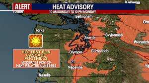
Stay alert to local fire restrictions and burn bans, and keep hydrated as conditions warm up again.
Source: Forecast information provided by FOX 13 Seattle Meteorologist Claire Anderson and the National Weather Service.